
This 19.6 km intermediate out-and-back route connects the wharves of Mont-Saint-Hilaire or Beloeil to Vary Wharf in Saint-Marc-sur-Richelieu. Taking approximately 3.5 to 6.5 hours to complete, the route follows the Richelieu River through a lively landscape of picturesque villages, agricultural scenery, and impressive views of Mount Saint-Hilaire. A rewarding adventure for paddlers looking to explore farther and experience the rich character of the region from the water.
La route bleue – Quai Richelieu/Quai du Vieux-Moulin au quai Vary
Contact details
Quai Richelieu
238 Chemin des Patriotes Nord, Mont-Saint-Hilaire, Québec, Canada, J3H 3H3
238 Chemin des Patriotes Nord, Mont-Saint-Hilaire, Québec, Canada, J3H 3H3
45.56982976, -73.19584689
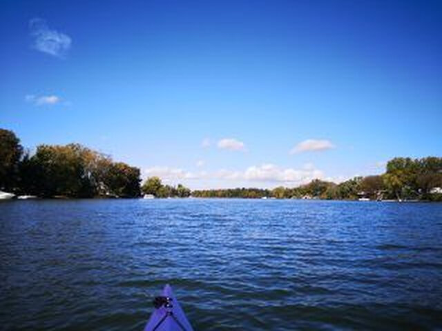
La route bleue - Rivière Richelieu - 1 © La route bleue

La route bleue - Rivière Richelieu - 2 © La route bleue

La route bleue - Rivière Richelieu - 3 © La route bleue

La route bleue - Rivière Richelieu - 4 © La route bleue




Activities
Water sports activities
Whitewater canoeing
Recreational canoeing
Whitewater kayaking
Sea kayaking
Recreational kayaking
Stand-up paddle boarding (SUP)
Rabaska
Facilities
Infrastructure and equipment
Boat ramp
Comfort and amenities
Restrooms
Services
Restaurant and food services
Picnic area
Rental
Recreational canoe
Recreational kayak
Stand-up paddle board
Life jacket
Getting there
Parking
Free on-site parking
Last updated: July 20, 2026
Discover nearby places









Recently viewed
La route bleue – Quai Richelieu/Quai du Vieux-Moulin au quai Vary is one of the outing ideas listed by Sortir au Québec in Mont-Saint-Hilaire. Explore more activities, festivals and discoveries across Québec.